Browns Canyon
Stage
Exploration
The Browns Canyon project consists of 146 unpatented mining claims and is 100% owned by ALLEGIANT, subject to underlying royalties. It is located on the highly prospective Battle Mountain Gold Trend of Nevada, which hosts some two dozen gold mines and over 100 million ounces of gold. Browns Canyon is approximately 20 km southwest of the Archimedes/Ruby Hill open pit gold mine.
Mineralization at Browns Canyon is Carlin-style, hosted in Devonian and Mississippian limestones, shales and siltstones. Surface sampling over the Browns Canyon project area has yielded a total of 5 separate geochemical anomalies with significant multi-gram gold samples:
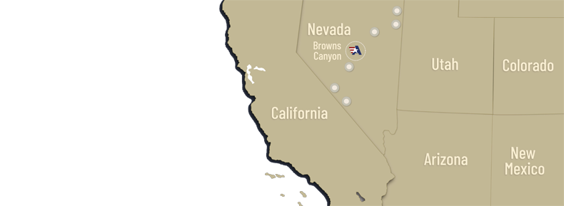
Click to view sample map showing the location of the gold anomalies
North Brown Anomaly
North Brown yielded a number of good assays, ranging from 1.5 to 9 g/t gold, from sampling of altered sedimentary rock and altered dike float. The nearest outcrops are Devonian limestone and siltstones with local zones of silicification. This Devonian stratigraphic section is widely recognized in Nevada as a favorable host for Carlin-type gold deposits. Many significant Carlin gold deposits, such as Alligator Ridge, Emigrant/Rain, and Dee/Arturo have been found in these rocks.
ALLEGIANT completed 2,036 meters of preliminary rotary drilling in 11 holes at the North Brown geochemical gold anomaly at the Browns Canyon project, in addition to geophysics, and geological interpretation. Although there were no reportable gold intercepts from any of the holes, this new work allowed ALLEGIANT to better understand the North Brown gold anomaly, with a view to targeting the source of the gold in the next round of drilling.
Excellent grade gold samples (from nil up to 9 g/t gold) at the North Brown gold anomaly are in angular, altered fragments, up to 0.3 meters in diameter, in a carbonate breccia horizon in the Devonian sequence. The breccia lies between massive limestone and siltstone. The breccia is thought to be along a flat fault and gold only occurs in some of the breccia fragments and not in the matrix of the breccia. The breccia is from 10 meters to 16 meters thick and was cut in several drill holes but only returned weakly anomalous drill intercepts (up to a maximum of 0.04 g/t gold).
ALLEGIANT believes the mineralized fragments in the breccia are transported along a flat fault from a local source near the North Brown anomaly. Field work and additional geophysical work will continue to discover the source of the mineralized breccia fragments.
Anomaly 3
A geologic mapping and geochemical grid sampling program taken along a silicified zone in 2011 defined a gold anomaly (from 10 ppb to 3 g/t gold) that is approximately 2,000 metres long and up to 390 metres wide. However, the gold anomaly may be even larger as the anomaly disappears under cover to the north, for approximately 600 metres, before reappearing for another 900 metres. The gold anomaly could be as long as 3,500 metres if it continues beneath the covered area.
In 1985 Cordex drilled seven vertical holes, ranging from 38 metres to 168 metres, at Browns Canyon and returned up to 9 metres of 0.82 g/t gold. However, the holes were drilled prior to the geochemical grid sampling program that identified the gold anomaly in 2011 and most of the holes were drilled to the south of where the gold anomaly is most prominent. In January 2012, Columbus Gold completed a drilling program consisting of 3,461.89 metres in 17 RC drill holes. This drilling established that gold mineralization at Browns Canyon appears stratiform and occurs along two gently dipping, stratigraphic horizons, one at the contact of clastic siltstones and sandstones and Devonian limestone, and another along the top of a limestone interbed in the clastic rocks, 30 metres above the Devonian contact. The mineralization, as drilled, extends for approximately 900 metres of strike, down dip for 100-150 metres from the surface, and remains open to the northwest on strike.
Anomaly 4
Anomaly 4, where gold values reach up to 3.19 g/t gold, is likely a continuation to the south of Anomaly 3. The geology is identical to that shown at Anomaly 3. A single 2012 drill hole was intended to test the gold values at Anomaly 4 but did not reach far enough before being abandoned due to difficult drilling.
ALLEGIANT plans additional surface sampling at Anomaly 4 and additional drilling.
Anomalies 2 and 5
Initial sampling at Anomaly 5 was particularly encouraging. Gold samples up to 3.2 g/t gold occur at Anomaly 5 in outcrops and float chips of jasperoid and iron-stained breccia along faults in a northeasterly zone about 760 meters long and about 50 meters wide.
An isolated 0.54 g/t gold surface sample occurs at Anomaly 2. The size of this anomaly is not known, nor its relationship to the nearby Anomaly 5.
Anomalies 2 and 5 have never been drilled and present excellent targets for Carlin-type gold mineralization. ALLEGIANT plans additional surface sampling and mapping, road and drill site construction, trenching, and drilling at Anomalies 5 and 2.