Overland Pass
Stage
Exploration
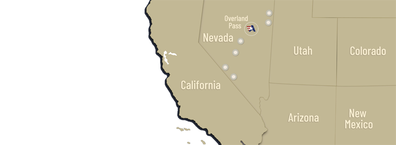
The Overland Pass Project is 100% owned by Allegiant, subject to underlying royalties, and is located approximately 90 km south of Elko, Nevada. Overland is situated at the southern end of the Carlin Trend, approximately 6.5 km north of Barrick Gold's Bald Mountain gold mine.
The geological setting at Overland Pass is very similar to that of the Alligator Ridge, approximately 18 km south, and Rain gold deposits, both of which produced in excess of one million ounces of gold.
Sampling at Overland Pass has yielded gold from silicified zones and breccia in the Pilot Shale and Joana Limestone. The favorable Pilot/Joana stratigraphic sequence is approximately 3 km long and surface sampling has returned up to 15.5 g/t gold, with nine samples exceeding 3 g/t gold.
Historic drilling by Santa Fe and Western States Minerals concentrated on the eastern portion of the claim block and most drill holes returned anomalous gold values, including 5 metres of 1 g/t gold. Columbus completed geologic mapping and sampling at Overland Pass prior to entering into a joint venture agreement with Sniper Resources. Sniper carried out a drill program in 2006/07 to test several northerly structural zones that cut favourable rocks, demonstrated to be gold-bearing from sampling, and to test the western half of the claim block, which had never been drilled and was thought to be a favourable environment for gold deposition based on geologic mapping and sampling.
Sniper’s reverse-circulation program totaled 2,222 metres and was comprised of 13 wide-spread, vertical and angle holes. Anomalous gold values were present in most of the holes, with the best-mineralized holes being OP-6 and OP-10. OP-6 returned 6.1 metres of 0.38 g/t from 45.7-51.8 metres, within a 15.2 metre zone averaging 0.27 g/t gold. Hole OP-10 was drilled from the same collar, but at a 30 degree difference in azimuth, and intercepted 3.05 metres of 1.37 g/t gold between 62.5-65.5 metres, within a 16.8 metre zone that averaged 0.51 g/t. Oxidation was extensive, suggesting favorable metallurgical characteristics. The mineralized zone appears to have been truncated by a faulted contact which suggests the zone may be thicker than drilled.
In January 2012, Sniper completed a Phase II RC drilling program that was comprised of 18 drill holes, totalling 2,225.04 metres. The drill program was designed to offset known oxide mineralization encountered in Sniper's 2006/2007 drilling to test undrilled surface geochemical anomalies, and to evaluate favourable host stratigraphic horizons at shallow depth from surface in several different areas. Results from 3 reported drill holes suggest continuity of stratigraphically controlled mineralization between the area of 2 Sniper holes and earlier drilling several hundred feet to the west, and widen the mineralized zone's footprint to approximately 400 feet.
For detailed results from the Phase II drilling program, please see Sniper release dated February 22, 2012 which is available on SEDAR at www.sedar.com. The Sniper earn-in agreement was terminated in 2014 and Allegiant holds 100% of Overland Pass.
Scientific and technical information contained in this section pertaining to work conducted by or on behalf of Sniper has been reviewed and approved by Douglas H. McGibbon, a director and the Vice-President, Exploration of Sniper, who Sniper has reported to be a "qualified person" within the meaning of National Instrument 43-101.